Two years ago, in a fit of "let's invest in the country", a "26 km" paved bicycle trail was built from Canmore to Banff (correction: a paved trail was built from the east edge of Banff National Park to the east edge of the Town of Banff. More on this distinction in a moment). This trail is popular, and has been attracting ~800 folks a day (mostly cyclists). It has been on our list of things to do for a while, so today, we rode it.
I mentioned here that there are things we could learn from the Dutch about making our neighbourhood cycle friendly. Despite how new it is, the Legacy Trail is not an example of how to do this.
For starters, the trail doesn't start at Canmore. It just starts/ends abruptly at the Banff Park east gates, which is some 4 km from the western edge of Canmore (but only 2 km from my house as the bike travels). The fact that it starts on the side of a busy highway in the middle of nowhere has been the subject of some controversy recently. There's no beginning to the trail, so folks are parking in the middle of the highway and jaywalking to get to the start. The short term solution has been to approve riding the wrong way on a one way bridge from Harvie Heights to get there. I rode that today. This is nasty and dangerous. It's not a busy bridge, but the cars on it do 110 km/hr, and the bikes do 20 km/hr in the opposite direction on a bridge with no shoulder. Then you get to ride on the gravel shoulder of a 110 km highway for 500 m, again riding the wrong way. Better than jaywalking, I guess, but only just. Here's hoping they put up concrete barriers. Soon. (2012 Update: There's a gravel road now leading from the end of the paved trail to just pass the base of the overpass that avoids riding on the highway. There's even parking for about 3 cars there)
The trail parallels and is never more than 10 m from the Trans Canada Highway virtually the whole way, normally right against the highway. This has already resulted in at least one near miss of a car careening off the highway and narrowly missing a cyclist. In addition, it's not really the "wilderness experience" one expects in a National Park. No, this is like riding your bike on a sidewalk attached to the Deerfoot Trail in Calgary (or an Autobahn, for my European readers).
The trail was VERY busy, with basically three different kinds of cyclists:
- Lance Armstrong wanna-bees. Dressed in advertising covered cycle shirts, many two sizes too small. Ages 20-60. Commonly overweight. Traveling 30-60 km/hr, and slow is bad. Training for an ultra marathon. Speed is the goal. Concentration the mantra. You are in their way. Move or you die.
- Dudes. Funky helmets. Whacked out (but likely expensive) bikes, usually big suspension mountain bikes. Could care less about others on the trail. You are in their way.
- Buddies (includes family groups). Want to stick together no matter what. If one pulls over, they all pull over, and stand in a pack, normally partially blocking the trail.
Cycling protocol on his trail is abysmal. Folks ride 2 and 3 abreast. Very few folks who passed us rang bells (or even called out) that they were passing, especially the Lance wanna-bees. Many folks wore no helmets. Great packs of folks were stopped on the path blocking the trail on the tops of the two "hills" you have to climb. It's not nice riding.
There's exactly one pull off to take a break on this trail, at a pretty uninspiring picnic spot about 5 km from the east end. The views up and down the valley are OK, if you stop (and many don't, especially the Lances and the Dudes).
 |
| Looking west towards Cascade Mountain |
 |
| Looking south towards Canmore. Note the bench. |
 |
| The Three Sisters, with some of this week's snow still present |
 |
| A plaque and solar powered night lights |
 |
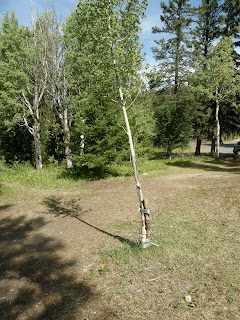
| The base is taped to stakes with duct tape. How Canadian. |
But the trail really isn't that scenic. It's also not 26 km. According to my GPS, it's 17 km from the start at the east gates to the rather abrupt termination in the town of Banff (do you suppose someone got paid for that 9 km of pavement that wasn't built?). And the paved bike path itself just stops in Banff, much as it stops at the east end of the park. It stops in Banff on the wrong side of a busy 4 lane road that is technically designated as a biking road, but with no crosswalk to get to the correct side to ride on. It's 200 m from the end of the trail to a marked and signed crosswalk -- along a single lane poor sidewalk on the wrong side of the street. Banff's bike routes are crap, to say the least.
 |
| The Banff end. Literally. |
We rode through town, picnicked at the park, then went over to see Bow Falls. I had forgotten there were rapids above the falls.
 |
| The rapids above the falls |
 |
| The falls |
 |
| From below |
 |
| Rafters at the confluence of the Spray and Bow Rivers |
We had a tailwind on the way home, and hit speeds of +45 km/hr on the flats. Hint: the wind always blows from the west here. If you're going to ride this as an out and return, start at the Canmore end. We bucked a solid headwind riding in, and practically coasted all the way back.
The Legacy Trail has become really popular in it's short history. I suspect the main reason is because it's because it's a paved bike path, and the only long one in the area. It's obviously popular with the Olympic athletes that live and train in Canmore (and the associated fat old dudes who wish they had been Olympic athletes). There are far more scenic rides around, but none are as "safe" (if you call riding 10 feet from traffic traveling at 100 km/hr "safe"). I'm not a mountain biker dude, so it's supposed to be "my kinda trail", and in many ways it is. It's nice to know I can ride from my house to Banff townsite in about an hour.
I just don't think I'm going to do it very often.
See my 2012 update to this post here, and my 2013 update here.


2 comments:
I thought it was a fun ride and much a much better route that the TransCanada Highway with cars and truck whizzing by 80 km faster that you are travelling.
It is without question better than riding on the highway. The cars whizzing by you are now 20' away as opposed to 5' away. But it is not a wilderness ride, nor is it a peaceful quiet ride, nor is it that interesting a ride, nor is it an exceptionally relaxing ride.
Post a Comment