Before we left /’Ai-/Ais hot springs, I had to find out the source of all the water for the springs. I was disappointed.
 |
| The spring is under the arch |
 |
| This is it |
 |
| Obviously there is more water here than just the pathetic spring |
And all that green, by the way, is the Fish River, about 62 km as the crow flies downstream from our overlook of yesterday. Yes, /'Ai-/Ais is in the bottom of the Fish Canyon, but it's only ~200 m deep at this point.
Once we climbed out of the Fish Canyon, a road that is like driving through mining tailing piles…
 |
| The washboard is good, too |
 |
| Desolation with rocks |
 |
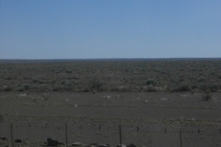
| Hmmmn.... not at all like an Alberta farm |
One of our stretch break/"pee in the woods" stops was under a tree with a nest complex of the Sociable Weaverbird. These dudes build one giant next for their colony.
 |
| A big tree with one big nest complex |
 |
| Home to hundreds |
 |
| The entrances in just one section |
 |
| Two separate yet connected colonies |
 |
| Backlit for artificial dramatic effect |
It’s interesting to find an acacia tree in the middle of nowhere.
 |
| Makes a good bathroom, too |
 |
| The narrow gauge railway |
 |
| An important railway deserves pretty bridges |
 |
| Wow! Water! In a river! Sort of! |
 |
| A huge herd |
 |
| It takes 4 to manage all 12 cows |
 |
| Ironed, again |
 |
| Like Saskatchewan, but without the excitement |
 |
| 98 km of our 550 km today was on pavement |
 |
| Straight and barren |
 |
| I suppose out here you should "stock up" when you shop |
 |
| Who said it was? |
 |
| Do animals drown in YOUR water supply? |
 |
| About 3"-4" long |
 |
| Acacia trees have tap roots up to 30 m deep |
 |
| Descending into the hills |
 |
| Penetrate 5 km straight ahead to find... |
 |
| Photo just does NOT do the place justice |
 |
| Our digs |
 |
| Opulent |
 |
| And the hills turn red |
 |
| Sunset glow |
 |
| Various colours of orange |
 |
| A sky colour rarely seen by me before |
 |
| Frickin' dude is huge |
The complex has a lit watering hole next to the dining area that is apparently popular with zebras and leopards. We hung out for a while near it, though saw nothing except bats. The stars, however, were amazing.
Today was not an inspired day. We were doused in road dust all day, and at the end of the day, we felt like a pile of grit. We took a dip in the pool to try and de-dust; mistake. The pool was FREEZING.
Tomorrow, however, is a BIG and exciting day. We’re up at 4:15 for a 5 AM departure to the Soussusvlei sand dunes, where we will climb Dune 45, visit Deadvlei, and hike the Sessrim Canyon.
==================
Today’s African Travel Tip: Namibian Road Numbering & Rivers
In Namibia, all roads have a letter and a number, like B27 and D414. The A roads are major highways, usually divided. The B roads are important and usually paved, but not always. The C roads are never paved. The D roads are only occasionally graded. While the paved roads are fine, anything from B on down become generally worse than any gravel road you have at home. The A through D roads are marked on my detailed Namibian map.
And I saw one E and two F “roads” today while having my butt vibrated off on the washboards of a D road (our Nomad team calls that “African massage”). E roads looked pitiful. I question whether an F road is really a road or is just, in fact, a designated 4X4 track.
Every day, we cross bridges over named rivers. In all of Namibia, only two of these rivers has had water in it (the Fish, that we saw today, and the Swakop over near Windhoek we'll see in a few days). Major cites are on major rivers, but there is no water. I guess the idea of a “river” in Namibia is somewhat “fluid”.


No comments:
Post a Comment