Our initial plan for our last day was to do the Cavell Meadows hike, but as I mentioned in an earlier post, that hike is closed due to a bear frequenting the area. So instead we decided to play tourist and poke at some view hotspots while heading home.
After a leisurely breakfast with, and goodbye to, my daughter, stop 1 was Pyramid Island about 2 km from Pyramid Lake Resort. Pyramid Mountain, and the other mountains in the area, were nicely reflected in the still morning water.
 |
| The island on the right |
 |
| Symmetry |
 |
| The Whistlers, Muhigan Mountain and others |
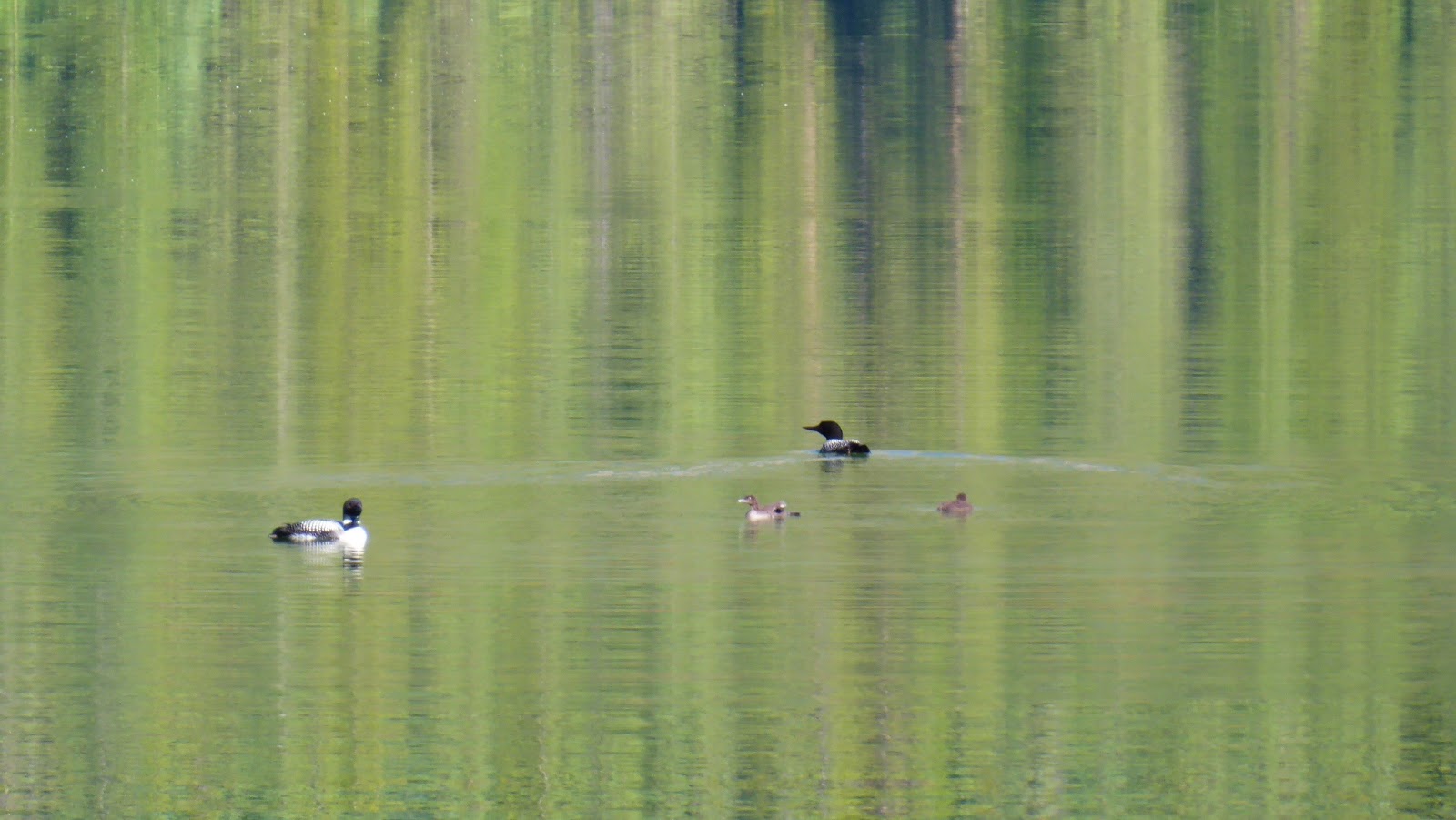
While we were waiting for my daughter to go hiking the previous day, we heard but didn't see loons. A mom and dad and two chicks were, this morning, hanging around Pyramid Island.
 |
| Mom and the kids |
 |
| Dad about to dive |
 |
| Mom in the sun |
 |
| Hanging around |
 |
| Colourful reflections |
 |
| The family that swims together... |
After a quick stop in Jasper, we puttered down the 93A (which REALLY needs re-paving) to Athabasca Falls.
 |
| Mt Kerkeslin and the Athabasca River |
 |
| The lip of the falls |
 |
| Looking downstream through the slot canyon |
 |
| The falls were churnin' |
 |
| A lot of water, from the other side |
 |
| "Somewhere, over the rainbow..." |
 |
| The 93A and footbridges cross the canyon |
 |
| Just downstream of the falls. All that water came through the slot |
 |
| The colourful peak of Kerkeslin. |
We saw American Dippers and Myrtle Warblers getting at the bugs near the lip of the falls.
 |
| Mr. Warbler after a successful bug hunt |
We stopped at the Goats and Glaciers viewpoint but there were no goats. There were really no glaciers, either, but lots of evidence of past glaciation.
 |
| Aretes, moraines and hanging valleys on Mt. Geraldine |
We then stopped at Sunwapta Falls.
 |
| Not at big but just as much fun |
 |
| Yet another slot canyon that leads to another falls |
At this point it was lunch time, so we wanted to picnic somewhere on our way south. A picnic area marked on our map (Bubbling Springs) has been decommissioned, though we should have stopped to see the now unmarked springs. Getting hungrier and hungrier, it tuns out there's basically no place to stop for a picnic between Sunwapta Falls and the Columbia Icefield. We finally pulled off at the Stutfield Glacier viewpoint which was marked as a picnic spot; there was one table and hoards of tourists.
 |
| The Stutfield, which comes off the Columbia Ice Sheet at the top |
 |
| The left side |
The Stutfield is interesting because as ice comes down it and falls off, it re-connects with ice below and re-forms as another glacier that's ~1.5 km long in the valley below.
We pause at an unnamed pullout to gawk at the various glaciers around the icefield, and watch the throngs of tourists without entering the parking lot.
 |
| Dome Glacier |
 |
| Close up of the Dome |
 |
| The unnamed glacier on Mt. Athabasca |
 |
| The Sunwapta River comes off the Athabasca Glacier |
 |
| Two groups out for guided walks on the Athabasca glacier |
 |
| Closeup of one group |
 |
| The famous snowcoaches load and unload |
 |
| Unnamed glaciers on Mt. Andromeda |
 |
| A closeup |
 |
| The start of the Athabasca Glacier |
 |
| The Athabasca Glacier |
Stats & facts on the Athabasca Glacier:
- It's about 6 km long back to the Columbia Icefield, up to 320 m thick and up to 1.3 km wide
- Being a glacier, it's always moving forward, about 120 m/yr or 30 cm/day at it's fastest spot (at the base of the icefall in the photo) and 15 m/yr or 4 cm/day at the toe
- But it's also always melting. The current retreat rate of the toe is about 20 m/yr, meaning that it's melting at the rate of 35 m/yr or 10 cm/day (advance rate less retreat rate) at the toe
- The Athabasca glacier does not source the Athabasca River. It sources the Sunwapta River. The Athabasca River is sourced by the Columbia Glacier from one of several lakes called Columbia Lake.
- The Athabasca Glacier is not on Mt. Athabasca; it's between Mt. Andromeda and Snow Dome.
We started to head home from here and soon ran into a bear jam, half way between the Rampart Creek Hostel and Saskatchewan River Crossing.
 |
| Maybe 50 cars? |
The bear is visible in the photo, just. He's that small, shadow-like black spot next to the lead blue car on the shoulder on the left. The bear was working his way towards us eating in the ditch right next to the road. A car would pull over next to the bear and park, and then the next car would leapfrog and park, and the bear would just continue to walk by car after car. One idiot in a white SUV pulled over and then crept forward at bear-walking speed, paralleling the bear for at least a minute.
 |
| And you wonder why bears get mad |
On the bright side, no one was out of their car.
We passed by Bow Lake and saw Bow Falls was in full tilt flow, the Bow Glacier above it. The view made me want to go hike there again, as we did here and here and a bunch of other times.
 |
| Getting to the base of the falls is one of my favourite walks |
Karen was tempted to take the 1A from Lake Louise to Banff, but I had had my fill of tourist drivers for the day.


No comments:
Post a Comment