Saturday, 12 September 2015

Sept 11: Commonwealth Valley, Finally

It was finally a perfect "fall" day to get up into Commonwealth valley to the Birdwood Lakes, where we've been trying to go for a month. Only the "we" that went today was my friend Monty and me. Sadly, Karen twisted her knee working on cameras this week, so is on rest and ice and physio -- and not hiking 19 km.

The trailhead is very near my favourite moose meadow, and there were a phalanx of people out moosewatching, including a guy from Idaho who owns a place in Banff but always comes down here to find moose. There were 3 moose, a girl in a nearby bog...
They actually eat the mud
...and a boy with a huge rack plus his girlfriend way on the far side of the marshes.
Boy laying down in the centre, girlfriend on right
The hike itself starts with a mostly boring 3 km trek down an old logging road. We brought our bikes for this section. The road is easy to bike...
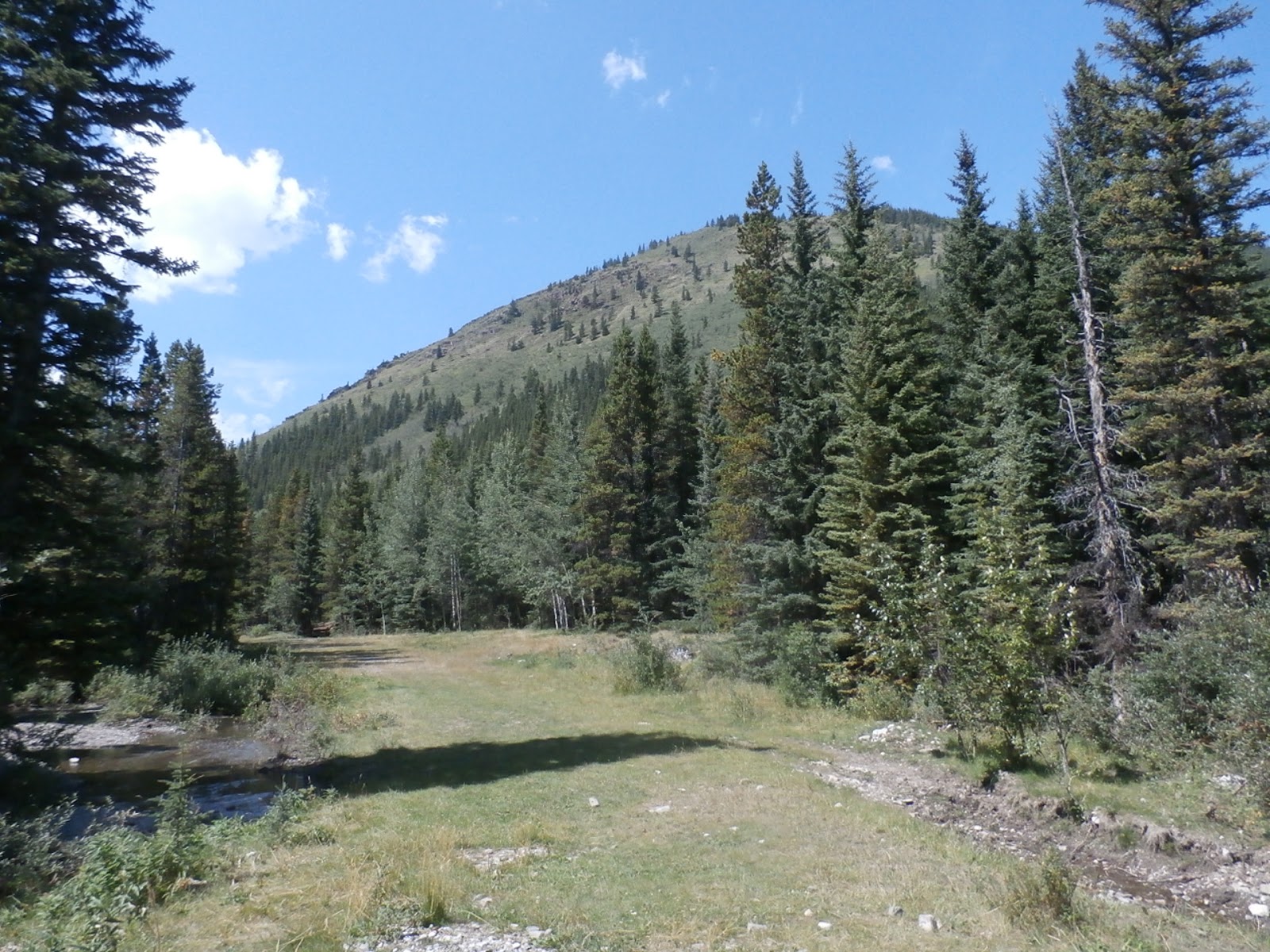
Most of the road looks like this
...but the guidebook instructions say head to a Y intersection then continue biking on the right logging road fork for an additional kilometre or so. Um, no. Biking to the Y is a breeze. Here's the trail after that:
Easy biking...
Not only that, about 200 m from the Y, there are 3 huge downed trees over which you have to lift your bike. No. Just park at the Y and walk.

Past here, the trail for the next 5 km is obvious but narrow, narrow, narrow as you squeeze through trees so tight your daypack barely fits. First stop is the waterfall on Commonwealth Creek.
The main falls  
Rapids above the falls 
Three baby falls
The trail is tight against the canyon walls here, muddy, slippery and in spots, boggy.
Trail glued on the hillside on right
The trail gets worse and worse underfoot until suddenly you pop out into the valley meadows.
Mt. Birdwood
The trail stays in the forest right at the meadow edge, and stays incredibly narrow. The meadow and its placid stream goes on and on.
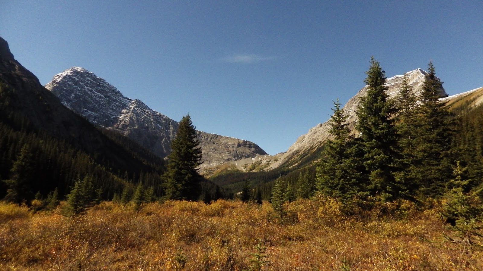
The target for the day is the gap in the middle 
The stream. It had moose prints in it.
It's a pleasant hour through this forest/meadow edge, however... this valley is grizzly country. Always. And last year, there was at least one bluff charge incident. So we were quite vigilant and found this very fresh scat that someone had stepped in today.
A big pile with a footprint in it 
A wet pile. They don't stay wet long
This has been a tough year for berries and bear food in general. The poop told me this one was eating cow parsnip, and while we found a fair amount of it, 90% of what we found was already dead. This poop was in a rare patch of still green stuff. 

We crossed under the avalanche slopes of The Fist...
The Fist on the right. You can scramble it from the col in the centre
...but mostly continued to plod through endless meadows shouting "Yo, bear!" at the top of our lungs about every minute.
More meadows
If you blow up the photo above, you can see the upper section of the trail cutting diagonally across the scree under the right hand slope of Birdwood. That's where we were heading, and it's almost 400 vertical m above where we are.

The meadows end for a bit at a big scree slope that is undoubtedly flood damage.
A waterfall on the right, scree on the left 
Looking back
From here, the trail squeezes through the forest AGAIN for a kilometre  arriving at the final basin under Mt. Birdwood, looking up at it's nascent glacier.
The glacier under the sun
To this point, we had climbed all of 170 m in 7 km. In the next 1.5 km, we would climb almost 400 m -- an average 25% grade. Whomever built this trail doesn't like switchbacks. The first section is the worst, as it grinds straight up a moist greasy slope. After once very brief, flat-ish respite -- an OK lunch spot, it turns out, with this view... 
Mt. Smuts
...you just keep climbing up, traversing the scree...
For the record, rocks tumbled off the cliff behind us
Looking back at the traverse from the top
...until you get to the headwall.
Looking back at Rummel Pass
Turn around, and you see... nothing. It's a dry basin that might actually have water in it at spring melt. Climb another steep face, up another 40 m, and finally you see the first of the Birdwood Lakes.
Out of view lower right... 8 hikers picnicking. Mt. Smutwood behind
The "normal" route here is to drop the 20 m down to the lake, then skirt it on the left side to a trail in the grass, climbing up next to the waterfall on the left to the upper lake. Bah. On the left side of the slopes are two traverses that take you above the lakes.
Traverses visible on the left
Take the high one at first. The low one peters out and you just have to climb up to the upper one in a shale-filled gully. From there, again two traverses take off, a high and a low. Now take the low one. Both lead to what is affectionately called "Smutwood Pass", on the border of Banff Park.
The upper lake comes into view from the traverse
The upper lake under "Mt. Smutwood" 
Looking back at the lower lake
The views from Smutwood Pass are pretty nice.
Mt. Sir Douglas & it's glaciers, Mt. Snow  
Looking down towards White Man's Pass in Banff 
Mt. Smuts & the lower lake
Climbing "Mt. Smutwood" (an unofficial name for the unnamed peak) is popular and apparently not that hard. A party of 8 started heading up op it just as we started down. I wonder when they finished.

We headed down via the upper lake, and continued down beside the waterfall to the lower lake.
The upper lake's outflow 
Mt. Smuts towers 
The lake drains towards the waterfall 
Mt. Smutwood over the exit stream 
Mt. Smuts and the lower lake from the top of the waterfall 
The waterfall 
The waterfall creek flows into the lower lake
Alas, it was time to retrace our steps back down the incredibly steep slopes to the meadows, but not without a last look back at the lower lake and Mt. Smutwood.
Now it's green
The view across the valley to Rummel Pass, 9.5 km away
As we descended, I couldn't help but note that cow parsnip wasn't the only thing that my friends the grizzlies were eating.
Digging for ground squirrels
A fall "delicacy" is the golden mantled ground squirrel. Their dens are simple, never more than 1 m long or 0.5 m deep, usually only have 1 entrance, and have 1-3 squirrels in it. The dig above is about 1.5 m wide & 0.5 m deep. Probably took the bear about 5 min to dig. And the hillside was covered in old digs.

Aside from moose, the only other animal we saw to today was a chipmunk.
Good tasting grass
As we descended, we couldn't help but notice that there was more water in every waterfall and creek on the way down.
The falls on the backside of Piggy Plus
Commonwealth Falls again, in the afternoon sun
This hike was a lot of fun, but as my friend Monty said, "not for amateurs". Scrabbling around the waterfalls and through the bogs was "interesting", the hill climb to the lakes was a serious grunt, and this is bear country. It also took way longer than I thought; a 10:30 AM start (on bikes) resulted in a 5:30 PM finish to cover 19.5 km and climb 560 m. Considering that 6 km of the 19.5 were done on bikes at 20 km/hr, the time suggests that they add convenience, not speed.

It's also interesting that the lakes themselves have no outflow. You can see all the water going it, but it doesn't come out anywhere. Anyone want to bet this is the source of Karst Spring?

BTW, you may have noticed there were larches. Yep. But no, this isn't a great larch hike, since you have to go too far to see too few. The larches were just starting to turn, as you can tell in the photos, and while the willows and bushes in the meadows were in nice colours, the larches won't be "in" for another 5-7 days.

Sunday, 6 September 2015

Aug 11: Not Mt. Burke

The top priority for my trip to south Kananaskis was Plateau Mountain. The second was getting to the old Cameron Fire Lookout on the top of Mt. Burke, which loomed large, towering 850 above our campsite.
WAY up there
When we last heard the forecast, we had nothing but sunshine and warm temps for our week. The trailhead is in the campground we we in. We were ready. We were stoked.

At 6 AM, we were woken by the gentle sound of raindrops on the tent. Rain? It got harder and harder, and by 7:30 AM, it was pouring. I got up for a moment to check things out. Not only was it cold and raining, it was overcast and the top of Mt. Burke was missing in clouds.

Bah.

So we went back to our sleeping bags. We were roused from our extended sleep by beaming sun at 10:00 AM. We got up to a cloudless sky and perfect temps with practically no wind.

Bah.

Had we arisen at 7:30, Burke would have been an easy get. But arising at 10 AM, there was too much distance and to much vert to get back at any reasonable hour. Frustrating.

We got up and studied our maps and guidebooks. We needed something short, straightforward and fun. We landed on climbing a small mountain near the Etherington campground called Three Cairns, so named for the three cairns on its top built by visitors. If you're interested, it's hike #55, Vol 5, 4th Edition of Gillean Daffern's fabulous Kananaskis Country Trails Guide.

We were so late, we had lunch in the Etherington campground before starting out. We thought our campground was empty. Of the 60 sites in that campground, exactly 1 was occupied. And we thought about making reservations.
Heading north towards Etherington 
The trail start 
The planned destination
This is a different area of K-Country than I'm used to. It's not really a hiking destination; there are no official or maintained hiking trails. All the trails around here are old logging roads, and they are maintained as winter snowmobile trails. Long, straight, flat and wide, with large old bridges crossing creeks. The primary summer users are horse parties, and in fact, Etherington has an equestrian campground that comes complete with corral space for horses. A few of those sites were occupied, and there were a dozen horses tied up as we wandered by.

I was not surprised that Etherington campground had a cougar warning recently. We walked by a bunch of very large pussy cat tracks.
Cougar
The fact that this is an old road is obvious, and in hindsight, we should have brought our bikes, for the riding would have been easier than Plateau.

Road eaten by river flood damage 
Bypass trail on right around it
Our destination looms
So Gillean says she has been up the hill a number of times. I would have thought that just tackling the slope in the photo above would have been reasonable, but she said there was an easier way. She said to climb the next ridge over, then cross. Well, we tried and failed. The capture from Google Earth below shows our route.
Target is the top of the first ridge, not the second
Gill said we would climb in grass and meadows almost the whole way up. Well, not so much. "Thinning in the dense forest", yes, meadows, not so much. We got to the point where we were supposed to start the climb up, and found an obvious path. Thinking we were on the right track, we followed it. And it led to...
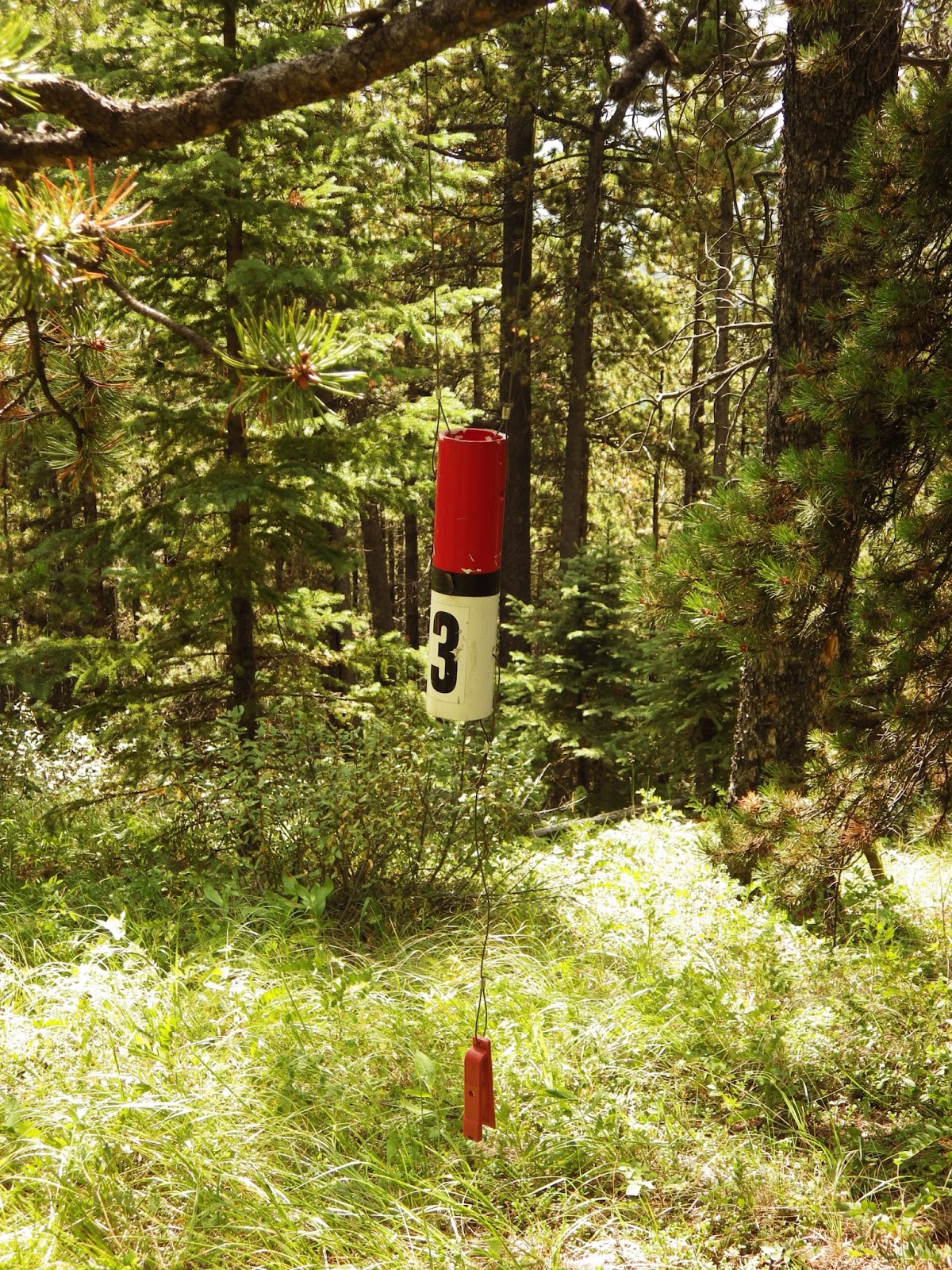
Number 2
...an orienteering marker. Hmmnnn. We veered back left a little, passed through the only thing that could constitute a meadow...
Not even 100 m up. Trail "start" in the small clearing left centre 
Looking to the west 
Near the top of the meadow, a 40° slope
Supposedly looking for bits of trail and sort of clearings, we trudged up through thin-ish forest on the top of a rock rib uphill for an hour, gaining 300 m. It was steep and not easy going with practically no views, and it was getting hotter as the day progressed. After an hour, a sort-of trail appeared. It led to...
Number 3
...another orienteering marker. Bah. Just past there, any semblance of a trail disappeared, the thinning died, the forest got dense, and the climbing harder. This was the view from the last clearing, 300 m above the valley where we started up.
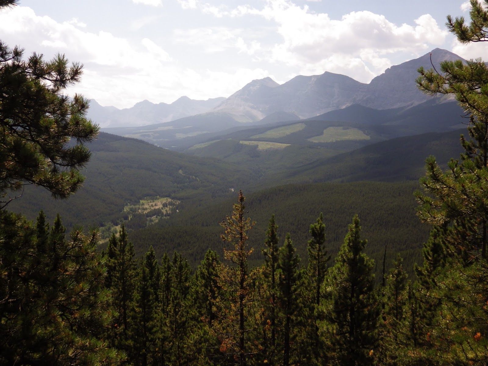
Southwest over the cutblocks 
More southwest 
Due west 
More westerly
Gill's instruction's were to climb to 40 m below the ridge's summit, then take a line under the summit to a UTM coordinate on the col between the two ridges. Yeah, right. My altimeter, maps and GPS all confirmed we got within 30 m of the forested summit, and the forest we were supposed to cut through was brutal. A 50° slope that we had to cross on a sidehill, full of chest high matchstick deadfall, and we needed to go through 300 m of it. We poked and prodded for about 15 min and found no viable route.

Hot, frustrated, weary, and generally unhappy, we decided to bail. While it took an hour to climb, it took just 30 min to descend. Running at the bottom was cold and lovely Etherington Creek.
A pretty little creek 
Cool and green and shady
By this time, it was up around 32°. The cold water was joyous. And...

I need to mention that the water in the campgrounds down here is not for drinking. Now, that having been said, I have a treatment system, but when I say "unfit for drinking", the water was a lovely rust-brown colour. I can treat out any bacteria, but the rust, not so much. We were therefore generally running out of drinking water at the campsite. We had decided to hit the store (yes, there is one nearby, 15 km to the north of us) and buy water. But...

Here I was at a cold, clear stream, and I had my water treatment system with me. Happiness. So we dumped the warm water we had, and I treated up almost 5 litres of icy cold creek water.
My device in action
FYI, I use a SteriPen to treat my water. We used it in Africa, too.

Could we have made Mt. Burke today? Maybe not. It was darn hot, not much wind, and we probably would have fried on the exposed area above treeline. But it would have been nice to have actually made a summit.