I am an admitted geology geek (30+ years of working with them rubbed off on me), and as a result, hikes that have geological interest are big with me. There's one in Kananasakis that features rock glaciers. A rock glacier is like an pure ice glacier except it's much slower. Eroding rock falls into an accumulation zone, and gravity causes it to flow down hill. The accumulation zone can also filled with ice, and the ice inside the rock glacier assists in making it move. More rock accumulates than flows, so the flows last a long long time. While ice glaciers move meters a year, rock glaciers move centimeters a year.
The only trouble with the rock glaciers in Kananaskis is that getting there isn't half the fun. They're in a place called Red Basin. I've seen the ends of them back when we hiked Red Ridge. But I have always wanted to get a better look. The trouble is, you have to bush bash your way to the top of the shoulder of Mt. Buller to see them. There's really no trail. Today, the weather forecast was for perfect bush bashing weather. The topo map said it would be a 3.5 km hike climbing ~425 m. Gillean Daffern's latest edition of her fantastic Kananaskis Trails Guide said 4.9 km and 686 m height gain. A man with two watches never knows what time it is.
We started off searching for trails. The Pest Management dudes had been through here flagging trees and burning infected ones, but the "trails" they left didn't go anywhere. The game trails we found mostly went across the hill, not up it. We ended up following a weak occasional trail on the cliff edge above the creek for the first 45 minutes and 1.25 km. There were a couple of overlooks of the creek valley...
 |
| The deep creek valley. Trail to Red Ridge on the other side |
...that enabled views up the Spray Valley.
 |
| The Windtower and West Wind Pass |
 |
| Closeup on the Windtower. Trail to the top visible |
But generally, it was just finding your way through very dense bush with ridiculously soft moss underfoot that made walking nice but full of tripping hazards -- covered in flies. The woods were full of flies, mostly ones that didn't bite (except for the odd horsefly). No mosquitos, but at one point I had ~25 flies on me and KC had the same.
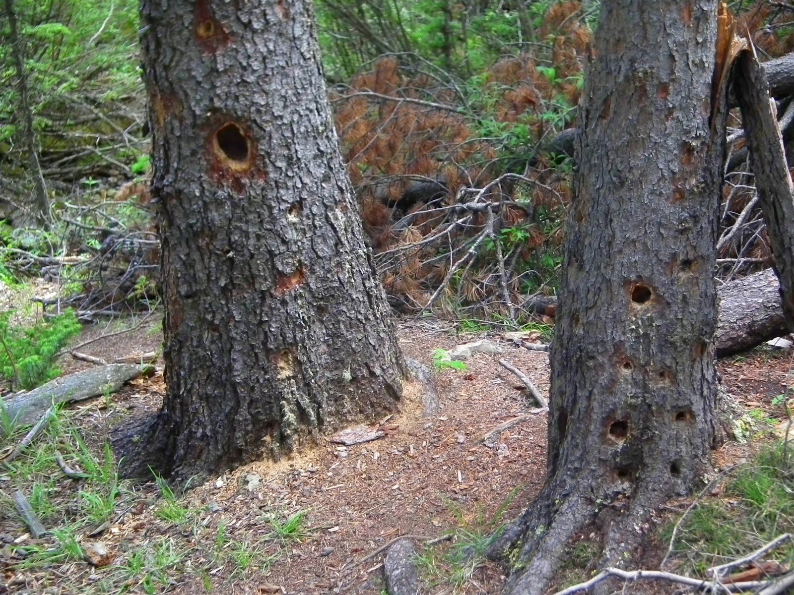
We finally ran across a weak trail heading generally upwards away from the creek's cliff edge. When I say "weak", it was tough to find it in the sunlight streaming into our faces, overgrown with bushes, and we lost it a dozen times or more. But the GPS said we were heading up correctly, and we checked it regularly. Then we ran into the densest collection of bear sign I have seen in a while.
 |
| Bear scat |
 |
| Rub trees |
 |
| Bear dig 1 |
 |
| Bear dig 2 |
Over the space of a kilometer, we saw probably 15+ bear scats, 3-5 rub trees and half a dozen trees that were scratched and clawed. All of it was fairly fresh, though some of the scat was probably a month or so old. So we started making LOTS of noise, and did so for the reminder of the hike, both up and down.
Suddenly we popped out on an open ridge edge above the basin we were heading for.
 |
| Oops |
This wasn't really expected. While we had climbed up ~410 m by this point, we were too far left on the ridge we were climbing, so we bush bashed for 10 more minutes towards the right. The trail description referred to "massive gashes filled with spruce". I'm not sure we knew they were there, but looking at the sat imagery, it's clear we ran the crest of 2 of them. They didn't look like gashes; they looked like creek drainages down into the basin. But by that time, we had no trails at all and the crests of them were easier to cross than the gullies.
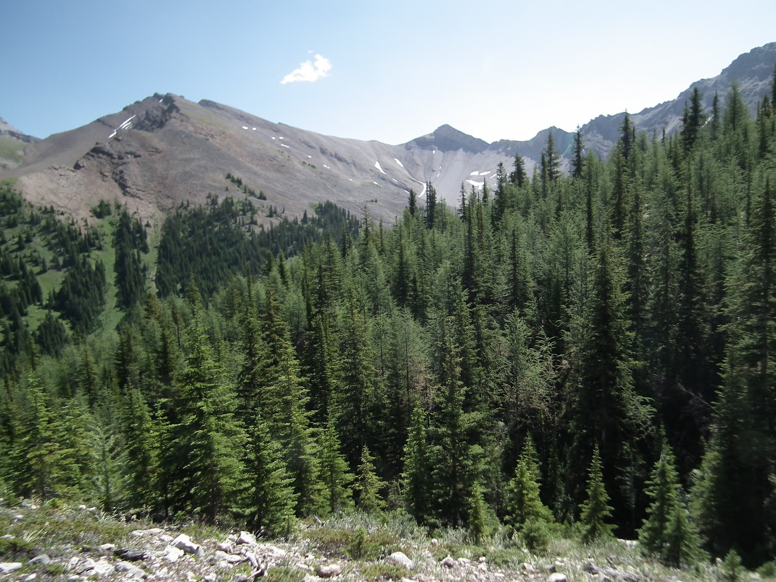
Suddenly we hit the right side of the ridge, telling us we were near the top. And boy did the views open up.
 |
| The last pull up on the ridge's west side |
Then we popped out onto the grassy ridgetop.
 |
| South down the Spray Lakes. Cone Mountain in the middle |
 |
| The ridge flanking Mt. Buller. We climbed it after lunch |
 |
| The giant boulders in the basin below Mt. Buller |
 |
| Mt. Nestor & Old Goat Mountains across the lake |
And the piece de resistance? The two rock glaciers.
 |
| Two lobes. Really big. |
The views from this point (after 4.7 km, 530 m climb and 2:15 of hiking), were stellar. We sat and ate lunch, then decided to climb a bit higher up Mt. Buller's flank to get even better views.
 |
| Up Spray Lakes. The tall one is the Big Sister. Rundle on the left. West Wind Pass in the middle |
 |
| The boulder field |
 |
| KC on top |
 |
| Mt. Sparrowhawk (Read's Tower and Red Ridge in the foreground) |
We only climbed up for about 15 minutes, and it was clear we could have gone higher and closer to Mt. Buller without much difficulty. But we wanted to see the boulders in the basin, so we headed down, dropping in from the col as instructed by Gillean, though finding no trail at all. We just generally kept right going down, and turned left when we saw rock though the forest. And when we stepped out, our jaws dropped again.
They're huge. Some are the size of houses.
 |
| Acres of rock |
 |
| Sauntering through |
 |
| The boulders with the glaciers in the background |
 |
| Home to pikas - sounds but no animals |
Wandering around was a kick. It would have been a fantastic place to play hide and seek. But we were both struck by the lack of animals. The odd pika shrieked at us. But there was no deer, elk or sheep poop. No marmots. No ground squirrels.
We climbed back out of the boulder basin to our lunch spot and then headed back down, trying to retrace our route. We thought coming down would be easier, but the game trails were so weak that we could be 20' off the route we took up and not see them. So we stopped a lot to check the GPS, getting back on track to the way we came up (which may or may not have been on a trail). We missed the bear digs, but saw lots of scat on the way down when we weren't near the route we took up. We ended up in dense bush too far left/west on a fairly frequent basis (I have the scratches to prove it) I think because that was the slope's fall line and whatever trail we had found on the way up was more angled. Remarkably, I got us back to the overlook over the creek valley that we were at earlier in the day. But I'm still not sure how we got up to that point, so we just faked it going down, bashing willows, chest high shepherdia and soft moss all the way.
I'm OK with bush bashing; it can be fun. But a trail to the top would have made this all much better.
All in all, we walked 9.5 km today, climbed ~650 m (including returning from the descent to the boulder basin) and spent 6 hrs on the trail. An earlier start might have enabled us to explore the basin farther, including getting to the rock glacier's toe.
Considering doing this?
- Take a GPS. I used both a map and compass and a GPS today. The GPS saved my bacon on several occasions.
- Take bear spray. Yell a lot. Pretty sure it's their living room.
- Know that you will spend 80% of your time off any trail, faking it though the woods. Don't be hesitant to just go for it, or you will waste lots of time wandering to and fro looking for trails that don't exist.
- Word has it that hunters like the place during hunting season. Orange is a lovely colour. I'm sure it will look good on you.
It's an awesome spot, and one I'm sure you will have to yourself.
 |
| The ridge from the parking lot. We got to the flat bit in the centre. |
 |
| Our route in Google Earth. Glaciers visible. Red Ridge on the left. |