I was monitoring the kananaskisblog.com post on where to hike post-flood, and Alf Skratins (local hiking legend -- or at least I think of him as one) posted on the status of the Spencer Creek meadows.
Never heard of the place -- and yet, it's a valley between two of my favourite valleys. I did some research and could find only one post about it. Apparently, it is an access route for a scree scramble up to the summit of Mt. Lougheed.
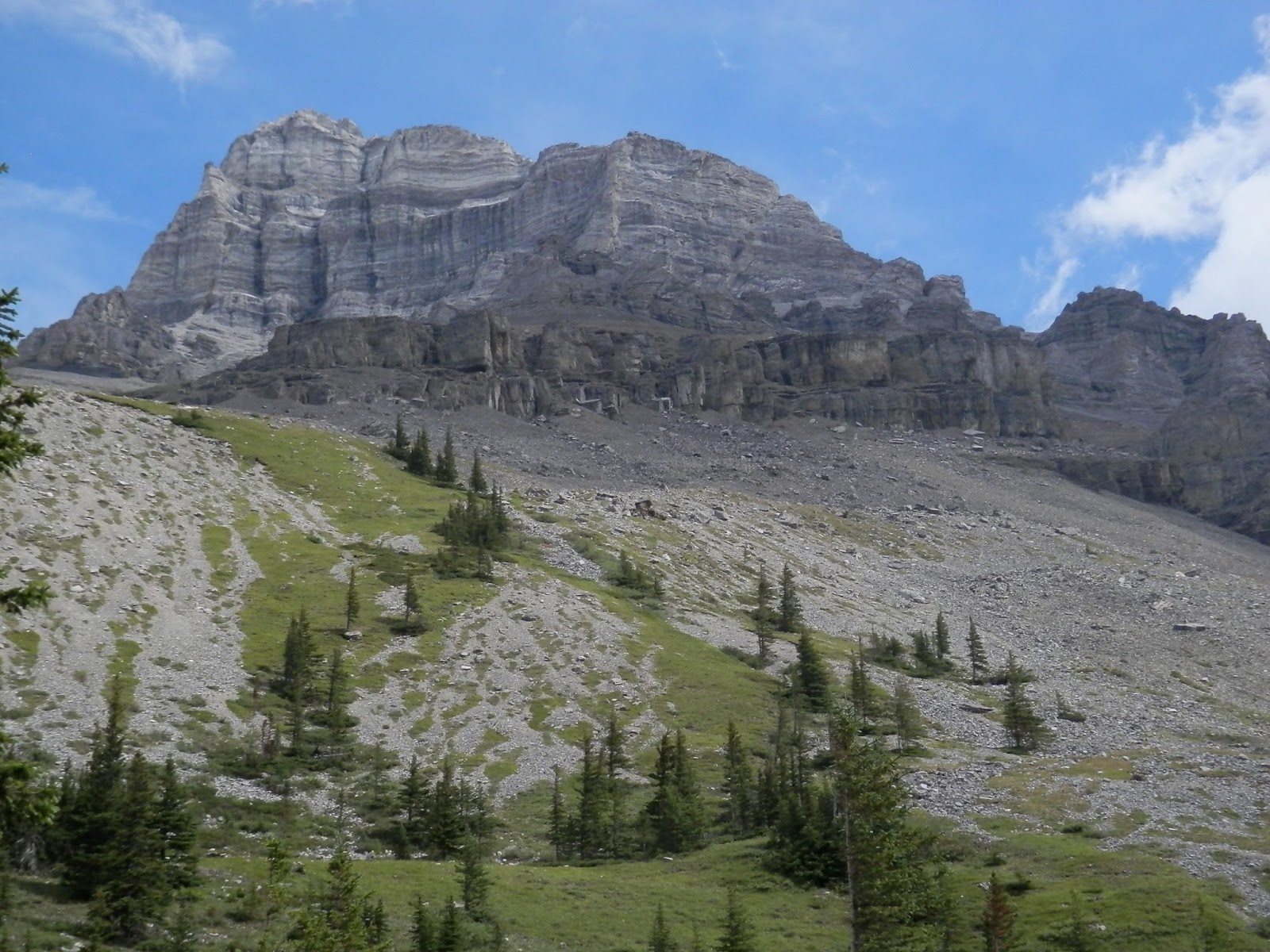
Well, what an absolute treat of a hike it turned out to be. This could very quickly become one of my favourite places. The trail is downright gorgeous. It's easy to follow, challenging but not hard, and enables lots of exploring potential. It's like a cross between Old Goat Glacier, West Wind Pass and Sparrowhawk Tarns.
The first 3 km climbs 270 m next to a babbling brook in a luxurious verdant mossy forest. It's absolutely gorgeous.
 |
| Braided chanels, evidence of flooding |
 |
| A lush walk |
 |
| The path & the stream, in harmony |
 |
| The vortex |
 |
| Up close |
Then the trail becomes just like West Wind Pass, skirting the edge of the creek valley with increasingly good views back to Spray Lakes.
 |
| One of the many places on the edge |
 |
| The waterfall in the gorge |
 |
| Me, on the lookout |
Then the trail gets a little more interesting, crossing steep creek gullies...
 |
| Looking almost straight down |
 |
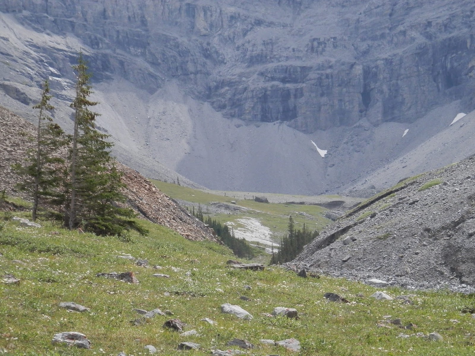
| The meadows under Lougheed in the distance |
 |
| A lot of rock. I'm getting used to seeing this. |
 |
| Looking ahead |
 |
| Looking back |
 |
| Up to that promontory |
 |
| Up a grassy slope to the back of Mt. Lougheed |
Exploring the basin was a blast, just like the Tarns. There's a little stream flowing down a "false fault" style crack in the rocks.
 |
| Head for this gully. Note the red rock on the left |
 |
| The slabs in the gully |
 |
| Down in the gully |
 |
| Me on the slabs |
 |
| The creek in the slabs |
 |
| The creek doing its carving thing |
 |
| Wind Mountain on the right |
 |
| The waterfall |
 |
| Getting up the undercut bank was tricky |
 |
| Heading to the basin |
 |
| That's me in the middle... |
 |
| My view from that point |
 |
| Being stared at |
 |
| Scampering |
 |
| Heading home |
 |
| They walk faster on this stuff than I do |
 |
| KC grunts her way up the last bit |
 |
| Looking back at Spray Lakes from part way up |
 |
| The view from the "ridge top". Pika rockpile in the middle |
 |
| Big thunderstorm. Grotto in the foreground |
 |
| This is the one that hit us. Pigeon on the left |
Yes, I could get to like this place.


1 comment:
From the grassy meadows near the Mt. Lougheed waterfall, I have contoured on a pretty good sheep trail up onto a bit of a bench above the red rock slope. After following this bench a while, you need to angle up once more on one of a couple of sheep trails across a scree slope...but don't go too high. This leads to a nice, grassy bench that contours along below some really interesting cliffs. This benched descends a bit...probably to the spot that you got to on your steep grassy climb. From here, you can either descend the way you went down to the trail, or go up to a pass that leads to a little peak known as "Little Lougheed". There is also a route that goes up the SW ridge of Little Lougheed.
I believe the basic trail will be described in Gilleans new "Volume 3" book, which should be in the stores shortly.
Alf
Post a Comment