Saturday 28 July 2012

Old Baldy: Thwarted (but Pikas!)

The weather forecast for Friday (yesterday) was calling for sunny skies with some risk of afternoon thunderstorms, and so we opted to try and climb a mountain: The Old Baldy summit down south of Kananaskis Village.


Weather forecasts are often wrong. A thunderstorm moved through at 9 AM while we were still eating breakfast, dumping rain for half an hour. While the hike is a bit of a drive from our house, as the crow flies it's only ~34 km, and sure enough, the trail was part river when we got there. However, part river is good for making mud which is good for making animal tracks.
A wolf track. Going our way.
The trail starts by following a fire road for ~2 km, then turns up to follow a creek which was in full flow.
The creek comes down and flows along the road a bit
The creek valley was neat in the morning sunshine, as it was misty, humid and steamy, despite temps of only ~20°. I tried to capture the mists but couldn't get a good photo. We did see a set of rub trees, however:
Two rubs
The trail writeup said that the trail had to cross some very steep creek banks in a few spots. I suspect the description was written before the recent rains, for at one point, there is no trail. All there is, is a wall crawl above 5' deep fast flowing icy cold water.
The trail stops at the wall 
KC crawls the wall
There are other spots where the trail is 30 m above the creek on the side of the bank. The trail, while narrow, is OK, though turning right is not recommended.
Life on the edge
I suspect the trail would be less of a challenge if every rock and root wasn't so slippery due to rain we had today.


Eventually, the trail arrives at a "fork" in the creek. It's hard to call it a fork, because only one of the two merging valleys has a creek in it. Anyway, a cairn says "stay left" in the valley with no creek, and the dry (occasionally creek filled) valley eventually opens up.
Still challenging walking
Finally, after 2 hours 45 minutes of hiking and 710 m of climbing, we arrived at the basin below the summit. We expected to see a tarn. No tarn.
Who took the tarn? Mosquito breeding ponds abound
Still, the basin was pretty, and we were starved. So we grabbed a rock, ate some lunch, and watched the pikas and marmots (and the odd columbian ground squirrel) while wrapped up to avoid being bitten by the numerous mosquitos and deer flies.
My favourite animals 
Hiding in the rocks
Running
From our lunch stop, we contemplated the route to the top, only ~150 vertical meters above.
Head to the trees on the right, then climb the grass slopes up
However... see that white sky? It was the edge of an oncoming thunderstorm.
Ominous black clouds appear
Before we finished lunch, it had started to rain. We debated the merits of doing a steep, slippery grassy slope in the rain. Then we saw lightning and heard thunder. Don't want to be standing on the top of a mountain with metal hiking poles in a lightning storm. So rather than climb the hill, we decided to wander around in the basin in the rain. And we found the tarn, which was tucked around the corner from our lunch spot.
The tarn and the back of the basin 
Note the cairns marking the route up

Cool rock formations, caused by a little thrust fault in the area
We spent an hour wandering around in the rain and thunder, and found a vertebrae of something, probably a sheep.
You gotta have backbone to live up here
We looked back on the hill that we planned to, but didn't climb.
The last 150 m. Easy peasy.
Alas, we decided to head down, giving up just shy of achieving our goal. The rain was lightening up when we saw more pikas and a family of marmots. I often see solo marmots, but have never seen them being this social.
Two playing 
A third arrives 
Mutual goofing about 
Two head off
The two that headed off climbed straight up the talus slope about 100 m in about 2 minutes. Wish I could do that.


On the way down the skies cleared...
An unnamed peak south of Mt. McDougall (see below)
...but only for a while, as another thunderstorm moved in.
Ominous dark clouds arriving over The Fortress
Sure enough, it started raining just as we got to the wall crawl (which for the record was much easier coming down than going up).


That unnamed peak in the above photo, by the way, is referred to as "Volcano Peak" and is an "easy" scrambling destination according to Andrew Nugara in his book "More Scrambles in the Canadian Rockies". He uses it as an approach route to Mt. McDougall, but considers it a good destination all on its own. Bob Spirko calls it "Little McDougall" and his write up of getting up there can be seen here and here.


Socked in and raining lightly in the creek valley, it was nonetheless a pleasant walk, as the creek opens up in spots, and there's interesting stuff.
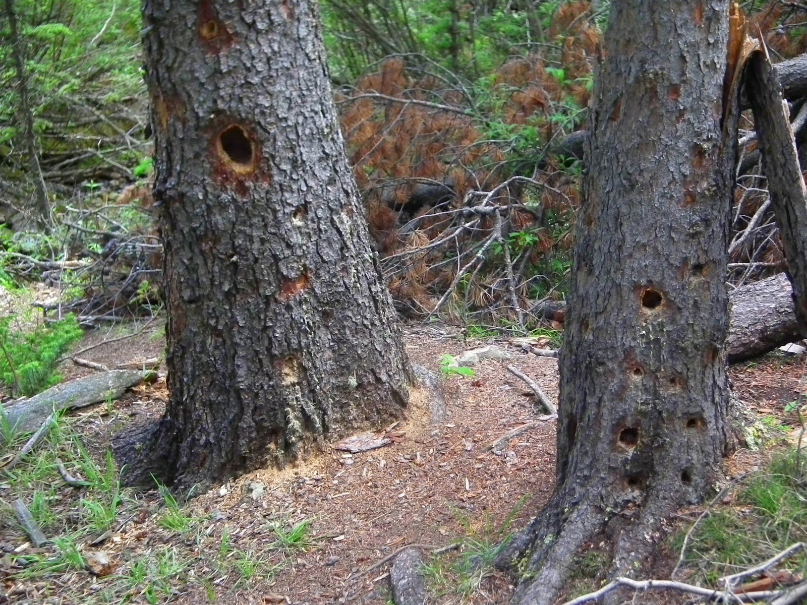
Woodpecker holes 
Lush and green 
More lush and green
Once again, rain = mud, and mud = tracks. We looked for tracks on the way in this morning, and saw only one occasional set of human footprints, plus some horse tracks and the single wolf paw print I posted above. Coming back we found two mountain bike tracks, some deer and a wolf (or two). The wolf was heading north on the short stretch of trail leading from The Wedge Connector trail along the Evan Thomas fire road. He was easy to follow; he left lots of tracks.
Big feet 
One? Or two?
As if we hadn't had enough rain for today, a final thunderstorm appeared just as we made it back to the car.
Socking in to the west
I was really disappointed we went all that way (15 km round trip, 700 m climbing plus 6.5 hrs on the trail) but just missed the summit. As we fell just ~150 vertical meters short, it's tough to assess this hike. I don't think it's worth it if you don't make the summit. The tarn is nice, but so are Rummel, Chester, Tryst and Rawson Lakes, and their trails are a lot nicer. The basin around the tarn is OK, but Sparrowhawk is much better, and it's easier to get to and offers more wandring potential. The creek is pretty, but so is the creek below Old Goat Glacier and it has a nice waterfall at the end. So unless you're heading to a summit back there, I wouldn't be in a rush to get back up there.
The car & the mountain we didn't make it to the top of
BTW, we made it to treeline in the above photo. Frustrating, that.

1 comment:

Barry said...

Tough break. The steep grass slope was a challenge on dry grass. The broad, relatively flat top of Old Baldy would have made you a lightning rod in a large area. No doubt in my mind you made the right decision. I also know how frustrating it is to be so close. Safety first. Staying alive for another day. Good account and excellent photos.